

From the Start to the Heart
The Virginia Creeper Trail is open from the Start to the Heart, Abingdon to Damascus, about 17 miles. Bike outfitters are providing full rental and shuttle services from their Damascus storefronts to the Abingdon trailhead. The Virginia Creeper Trail is now open to e-bikes, too!
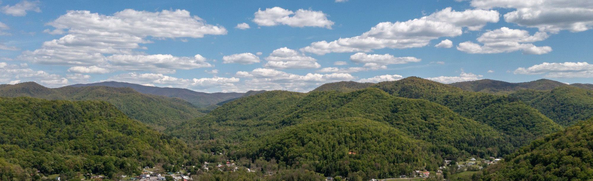
Bike through the rolling hills and farmland along the South Fork of the Holston River. At its lowest elevation, the trail crosses the headwaters of South Holston Lake on a huge curving trestle. Although the lower section of trail requires some light pedaling, it is downhill from Abingdon to Alvarado and maintains less than a 1% grade from Alvarado back to Damascus – suitable for active beginners and families.
On-Trail Amenities
Virginia Creeper Trail Parking
Free parking is available along the Virginia Creeper Trail at the Abingdon trailhead, Watauga, Alvarado Station, and the Damascus Town Park.
Virginia Creeper Trail Restrooms
Public restrooms are available at the Abingdon trailhead, Alvarado Station, and the Damascus Town Park.
Rest Stop: Alvarado Station Outpost
The Outpost at Alvarado Station is staffed by the Town of Abingdon and stocked with drinks, snacks, and merch. Open daily 10am to 4:30pm from April through October.
Damascus Caboose
The historic Caboose at the Damascus Town Park is staffed by the Virginia Creeper Trail Conservancy. Open Friday to Sunday starting in May.


Book Your Next Trip!
Damascus has several local bike outfitters in town ready to assist with bike rental and shuttle services year-round. The Virginia Creeper Trail is a family-friendly rail-trail, suitable for beginners, and great for groups of all ages. There’s an adventure for everyone here!
All of the listed Bike Outfitters operate bike rentals and shuttles under commercial-use permits with the US Forest Service for the Mount Rogers National Recreation Area of the George Washington & Jefferson National Forests.

The Virginia Creeper National Recreation Trail
Named after the native vine Virginia Creeper (Parthenocissus quinquefolia) and inducted into the Rail-Trail Hall of Fame in 2014, the Virginia Creeper Trail is one of the most famous biking trails in the United States. The trail is family-friendly and great for beginners. The Virginia Creeper National Recreation Trail stretches 34 miles from Whitetop Station to the Abingdon terminus and passes right through the heart of downtown Damascus along the way.
The trail is highly accessible and several outfitters in Damascus offer bike rental and shuttle services to Abingdon and Alvarado year-round. The Virginia Creeper Trail also offers abundant access to fishing and swimming holes along Laurel Creek and the South Fork Holston River. Be sure to take enough time to stop along your ride for food, scenery, and historical sites.
An Award-Winning Trail
- Rail-Trail Hall of Fame (2014), Rails-to-Trails Conservancy
- Best Biking Trail of the Blue Ridge (2022-2026), Blue Ridge Outdoors Magazine
- #3 Best Recreational Trail, USA Today Reader’s Choice
- Best of Virginia: Hiking or Biking Trail, Virginia Living Magazine
- Best Biking Trail, Best Rail-to-Trail System, Blue Ridge Country Magazine
- Best Kid-Friendly Adventure (Runner-Up, 2026), Blue Ridge Outdoors Magazine
When is the Best Time to Visit?
Anytime! The trail is open and shuttles are available year-round!
April to May: Spring Wildflowers
Mid-June: Rhododendron Bloom
June to September: Swimming Holes
Mid-October: Peak Fall Color
November to March: Wide Open Winter Views


Upper Half Trail Closure
The upper half of the Virginia Creeper Trail from Whitetop Station to Damascus saw significant damage from Hurricane Helene in September 2024, and remains closed until it is rebuilt (estimated completion in Fall 2026). There is no access to the Virginia Creeper Trail past Damascus at this time.
Work Zone: Please be alert to signage and barricades on the trail. Respect trail closures for the safety of both the public and work crews.
Virginia Creeper Trail Groundbreaking
The Town of Damascus, Virginia was delighted to celebrate the groundbreaking of the upper half of the Virginia Creeper Trail alongside the US Forest Service, Kiewit Infrastructure South Co., the Commonwealth of Virginia, and many regional partners and community members, on Thursday, December 18th. This day marked a significant milestone in our recovery from Hurricane Helene in September 2024. As Mayor Lamb says, “We’re coming back better than we’ve ever been!” A year from now, we look forward to celebrating the ribbon-cutting with you. In the meantime, join us in enjoying the beautiful half of the Virginia Creeper Trail that remains open, from the Start to the Heart, Abingdon to Damascus.
Check our Damascus Area Trail Updates for the most current information on the Virginia Creeper Trail:
Trail Map: Abingdon to Damascus

Trail Etiquette and Safety
- The Virginia Creeper Trail is a multi-use trail open to bikes, e-bikes, horseback riding, hiking, and running. No motorized traffic.
- The trail crosses both private and public property. Please be respectful. Camp only where permitted. Never camp on private land without permission.
- Share the trail. Bicyclists should yield to all other trail users until it is safe to pass. When passing others, please call out, “Passing on your left!”.
- Horseback riders should allow bicyclists overtaking them to pass and dismount and lead their horses across trestles and bridges.
- Helmets are not required but HIGHLY recommended.
- Travel single file and keep to the right. When passing other users, call out, “Passing on your left!”.
- Keep bicycle speed under control, especially when traveling downhill. Keep your eyes on the trail and trail surface. Watch out for oncoming traffic, rocks, washouts, and other hazards.
- Pull off to the side of the trail when taking a break or enjoying the scenery. Do not stop on the trail or block gates.
- Obey all stop signs at road crossings. Vehicular traffic will not yield.
- Keep dogs on a leash not exceeding 6 feet in length.
- Pack out all litter – including cigarette butts and pet waste.
- No fireworks. No firearms, except off-trail in designated areas in the Mount Rogers National Recreation Area and during hunting season only.
- Find defibrillators (AEDs) and basic first aid supplies at Whitetop Station, Green Cove Station, and Alvarado Station (when open).
- In the event of an emergency, dial 9-1-1 with your location (nearest mile marker and/or trestle number). If cell service is not available, ask another trail user to go to the nearest house or station to call emergency services.

Hit the Trails Responsibly
To make the most of your time out on trail, it’s important to be kind, be aware, and be prepared. Here’s some local advice:
You must be logged in to post a comment.